
 9 months ago
 (200 x 200 px).png)
Wildfires and their burn scars have made portions of the trail more hazardous and forced hikers to contend with closures on quick notice. For some distance hikers, the blazes are changing their goals and turning them into witnesses of dramatic environmental change. Meanwhile, when fast-moving wildfires strike, many rural communities along the trail are finding themselves responsible for helping vulnerable hikers.
“Wildfire season is lasting longer, becoming less predictable, affecting more trail, more trail users and more trail communities,” Rylee said.
The PCT, the West Coast’s longer and more demanding answer to the Appalachian Trail, travels through the Mojave Desert, the Sierra Nevada and the Cascade Range. Between 6,000 and 8,000 people seek long-distance hiking permits from the trail association each year. Hundreds of thousands visit for shorter stints.
But intense wildfire seasons have transformed the landscape, fueled by extreme temperatures due to global warming, in combination with more than a century of aggressive fire suppression that created unhealthy forests.
The signals of climate change now stick out on the PCT, said John O’Brien, a California climate scientist who grew up near the trail and hikes on it frequently.
“It’s a long-term tour through climate history,” O’Brien said.
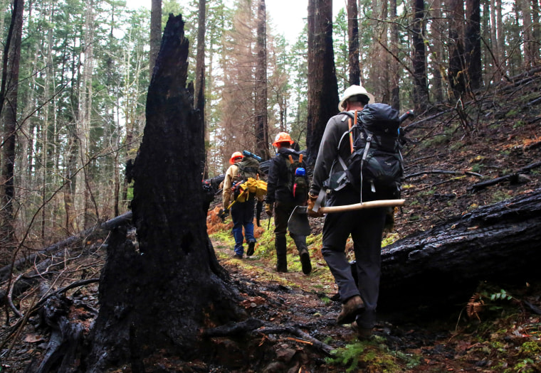 Trail crew workers on the Pacific Crest Trail as it winds through the burn area of the Eagle Creek Fire in the Columbia River Gorge near Portland, Ore., in 2018.Jamie Hale / The Oregonian via AP file
Beyond fire risk, climate change is causing water to become increasingly scarce in some areas along the trail. Glaciers are receding in the high country, often exposing slick bedrock. Streams often reach peak flow earlier in the season, which can make crossings at those times dangerous.
Koekkoek and Teesseling said fire was not the only extreme weather they faced. In Julian, California, a heavy late-season snow forced them to hunker down. Then, the pair suffered through a week of roughly 100-degree heat near Burney, California, even at high elevation.
They said locals they met kept repeating the same refrain: “We’ve never experienced this weather before.”
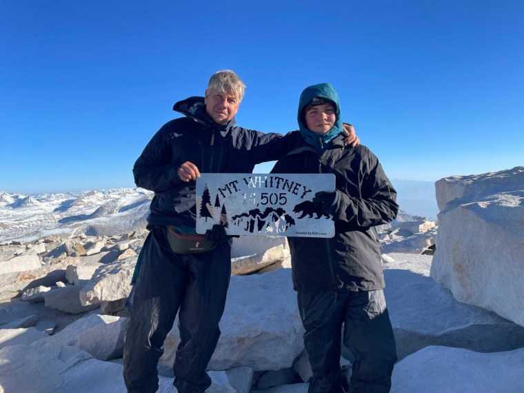 Thijs Koekkoek and his son, Taime Teesseling.Courtesy Thijs Koekkoek
The hike gave the father and son a crash course in how wildfires are changing daily life for remote, fire-prone communities, particularly in California: “Everyone had an escape bag at their front door, and everyone had to be ready to abandon their house,” Teesseling said.
PCT hikers, too, have to be on alert — when fires take off, they are among the most vulnerable. Many prepare for their journeys with the assumption that they will skip several sections of trail due to fires, or “flip-flop” — return back later. Others attempt to string together complicated workaround paths.
Karen Altergott, a 2022 thru-hiker, was forced off the trail near Stehekin, Washington, after she developed a hacking cough, headache and sore throat from three days of hiking through smoke.
“My lungs felt full of liquid,” she said. This year, Altergott returned to complete her missing miles and ended up hiking 17 miles in an N95 respirator. Then, a new fire left her 30 miles short of completion and yearning for closure.
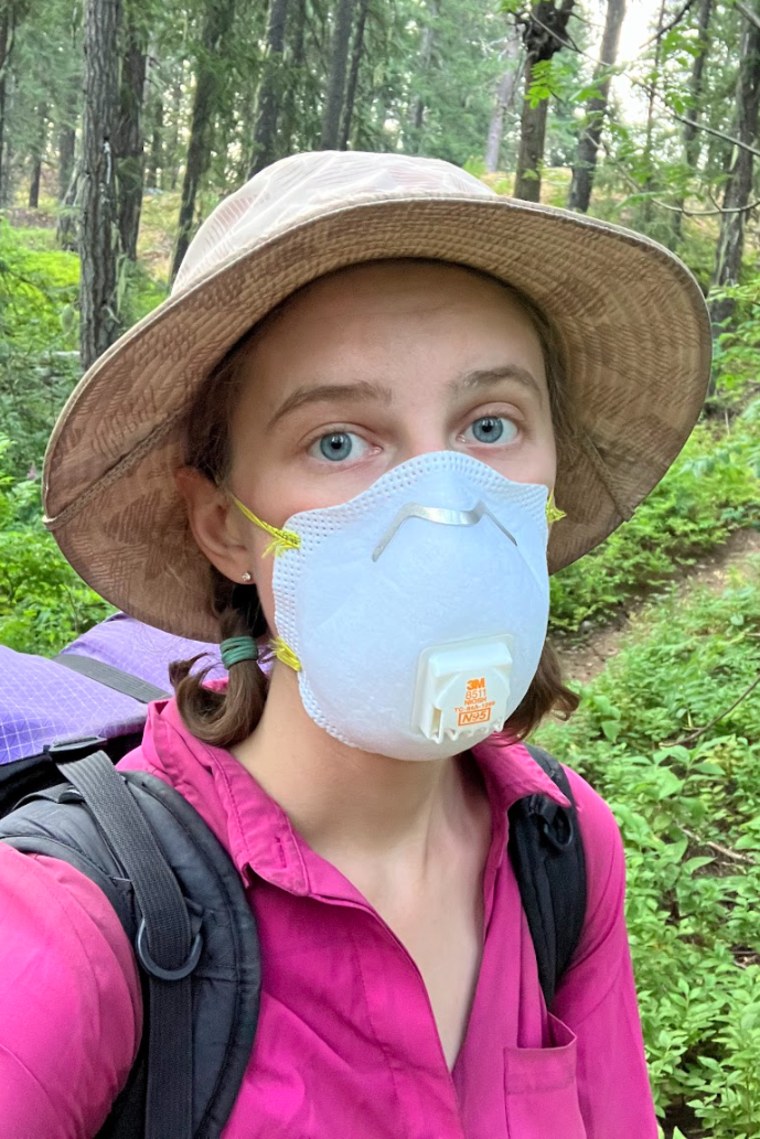 Karen Altergott.Courtesy Karen Altergott
“Part of me stayed out there,” Altergott said. “I firmly believe it is now impossible to hike the Pacific Crest Trail without being impacted by wildfires.”
The Pacific Crest Trail Association this summer launched a smartphone app to help hikers track and navigate frequent, confusing wildfire closures.
“Trail angels” — locals who offer distance hikers free food, support and places to stay — are increasingly playing essential safety roles by ferrying stranded hikers around fire closures.
“They’re literally on foot with their lives,” said Becky Wade, who serves as a trail angel with her partner, Jeff McCabe, in Hamburg, California. “They have no escape unless you stop up to help them.”
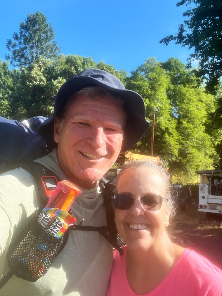 Becky Wade with her partner, Jeff McCabe.Courtesy Becky Wade
McCabe and Wade moved to the area, near the Klamath National Forest, four years ago. Wildfires have forced them to evacuate twice. Both times, they were hosting long-distance hikers and drove them to safety.
In July, McCabe ferried about 75 hikers around the Shelly Fire, including Koekkoek and Teesseling.
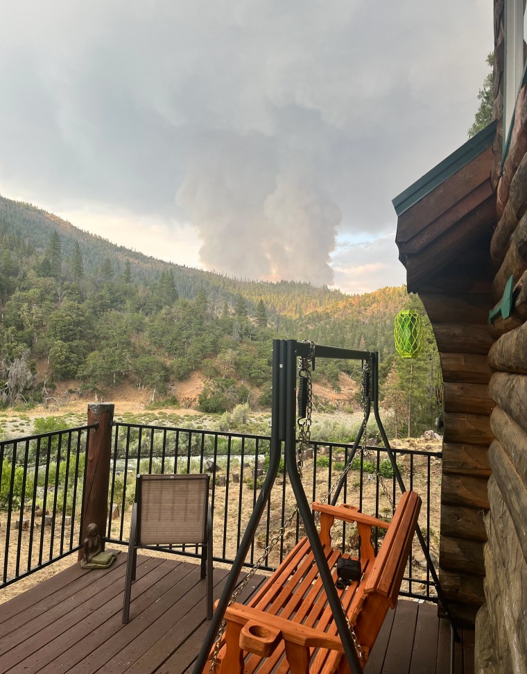 Smoke from the 2023 Head Fire is seen from Becky Wade and Jeff McCabe's deck. Courtesy Becky Wade
“It would be … way harder without people like the trail angels who are willing to drive you around the fires,” Teesseling said.
Even when hikers don’t encounter active fires, walking through burn zones is a stark reminder of climate change’s effects.
Will Georis, 25, hiked the PCT in 2022, the year after the Dixie Fire. The blaze left dozens of miles of burned-out stumps, unstable ground and a risk that wind gusts could transform burnt trees into widow-makers — the term hikers give to dead trees and branches at risk of toppling.
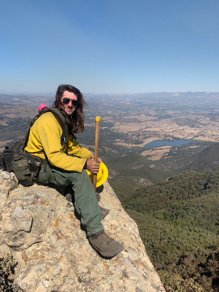 Will Georis.Courtesy Will Georis
“There’s no way around it — those huge areas where every tree is burned to the crisps or it felt like a bomb went off. It’s not enjoyable to hike,” said Georis, who worked as a wildland firefighter in college and is now a forester.
“The biodiversity is going to be different,” he added. “There will be different species coming in.”
Fire itself is not unnatural or bad. Before European settlers, some 4.5 million acres burned each year on average in California, according to researchers at the University of California, Berkeley — a mark that would top modern fire seasons.
But today’s forests aren’t as well adapted to fire, and they often burn hotter.
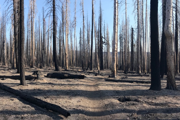 Karen Altergott passed through this burn zone in Lassen Volcanic National Park while hiking the Pacific Crest Trail in 2022.Courtesy Karen Altergott
“The fires of olden were low intensity,” O’Brien said. “That created these really resilient forests where the big trees’ lower branches burned, but their canopies stayed intact, and they survived and continued to grow.”
Georis succeeded in hiking a continuous path from Mexico to Canada, an experience that’s growing increasingly difficult. He urged future hikers not to be deterred by the possibility of confusing logistics, smoke and the need to be flexible with plans — a sentiment shared by many distance hikers who say the trail’s scenery and community still make it worthwhile.
Despite many hikers’ focus on walking a continuous path, Georis said, “when you get to the end, you realize that was the least important thing — it’s really the people and the experiences.”
Evan Bush is a science reporter for NBC News.
Nigel Chiwaya
contributed
.


 English (US) ·